Latitude/Longitude
and Topographical Maps
by Sister Marie Dianne, Bishop O'Connell
High School
 I. Key in for URL location:
(copy and paste this web address)
[ U.S.Geological Service ] (The
above banner is from www.usgs.gov)
http://www.usgs.gov/education/teacher/what-do-maps-show/WDMSact4.pdf
1. Print
all 4 pages
2. Answer
questions on these pages
I. Key in for URL location:
(copy and paste this web address)
[ U.S.Geological Service ] (The
above banner is from www.usgs.gov)
http://www.usgs.gov/education/teacher/what-do-maps-show/WDMSact4.pdf
1. Print
all 4 pages
2. Answer
questions on these pages
II. Go to: http://www.tropicsweather.com/hurtrac.html
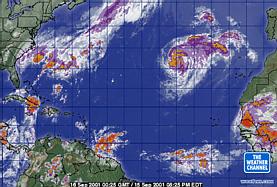 1) Print out
a Hurricane Tracking map
2) Plot
the path of Tropical Storm Gabrielle: (Using dots on your graph paper,
then connecting them...) Tracking Info For
Tropical Storm Gabrielle
1) Print out
a Hurricane Tracking map
2) Plot
the path of Tropical Storm Gabrielle: (Using dots on your graph paper,
then connecting them...) Tracking Info For
Tropical Storm Gabrielle
Time
Lat Lon Wind(mph) Pressure Storm type
-------------------------------------------------------------
21 GMT 09/11/01
25.5N 84.2W 30 1010 Tropical
Depression
15 GMT 09/12/01
25.7N 85.9W 30 1008 Tropical
Depression
15 GMT 09/14/01
27.6N 82.2W 60 986
Tropical Storm
09 GMT 09/15/01
28.7N 80.8W 45 995
Tropical Storm
21 GMT 09/15/01
30.1N 78.3W 50 999
Tropical Storm
Tropical Storm
Gabrielle ... from: the Weather Underground:
http://www.wunderground.com/tropical/at200108.track.html
http://www.weather.com/newscenter/tropical/archiveatlantic.html
*Plot these tracking
points for several other 2001 storms below, and LABEL them as:TD2, A, B,
C, D, and E.
| Allison |
30N |
95W |
| Barry |
32N |
67W |
| Chantal |
18N |
93W |
| Dean |
44N |
52W |
| Erin |
48N |
52W |
| TD2 |
13N |
40W |
** IF TIME PERMITS:
II.Point your browser
to TOPOZONE at http://www.topozone.com/
-
Do a Name Search for
Washington (State = District of Columbia)
-
Do a Name Search for
Seattle (State = Washington)
-
Do a Name Search for
any BASIN (State = Montana) Click on: Alaska Basin
-
Do a Name Search for
any VALLEY (State = VIRGINIA) Click on: Beech Spring
Hollow, Rappahannock, VA *Then click (top right)
LARGE
III.http://geology.er.usgs.gov/states/mid_atl.html
USGS Geologic
Info.about Mid-Atlantic States
1. ** Go to: http://energy.er.usgs.gov/products/maps/i2495/
2. Click on: "Stratigraphic
Framework of Cambrian and Ordovician Rocks in the Central Appalachian Basin
" Then Choose: "Stratigraphic Framework..." (=1st graphic on top left)..
3. Under "Explanation".
please list 5 different kinds of rocks that can be found in the Appalachian
Mountains.
(shale,
siltstone, sandstone, limestone, marble, and granite)
IV. Latitude/Longitude
activity for Pythagorean Theory
http://daniel.calpoly.edu/~dfrc/Robin/Latitude/pythag.html
< BACK
to Sister Dianne's Earth and Space Science Homepage
< RARE
Club

